Good
morning. I’m Carlie Kearns.
I
moved to Houston with my husband in August 1974.
Our
first outdoor adventures here were fishing trips along the Morice River. It is an
amazingly beautiful, pristine, and powerful river!
We’ve
camped, canoed, boated, and fished most of the river from the Morice West
Bridge to Barrett Station Bridge. We’ve caught Chinook, Pink, and Coho Salmon;
Rainbow Trout, Steelhead, and Dolly Varden. We’ve seen abundant wildlife and
birds along the river and picked berries and mushrooms nearby. It is idyllic! More
people every year access this area for the fishing and the wilderness
experience - locals as well as people from across Canada, the U.S., Asia, and
Europe.
This
prime fish & animal habitat is downstream from where the proposed oil
pipeline would parallel, then cross, the Morice River and parallel the Gosnel.
In
the spring, when the Morice becomes a raging brown torrent, our explorations
eventually took us to Babine Lake and Rainbow Alley – a world-renowned
fly-fishing paradise. In the spring and summer fishermen congregate in Rainbow
Alley and Nilkitkwa Lake to fish for rainbow trout. As you know, this area is also at risk -- 80%
of the Babine rainbow trout spawn in the Sutherland River downstream from the
proposed pipeline crossing of that river.
We’ve
also enjoyed fishing and boating in the Douglas Channel where I’ve seen whales,
halibut, crab, rock cod, salmon, starfish, multitudes of birds, and vast beds
of kelp.
The
cycles of nature sustained by the rivers, lakes, and ocean are immense – waterways
truly are the life blood of this province.
I
am horrified by the thought of an oil pipeline through this area and oil super tankers
traversing within the confines of the Douglas Channel.
Oil spills
are inevitable.
Last June I
wrote a letter to the Houston Today newspaper expressing my concerns about the
risk of spills. The following week Mr. John Carruthers, President of Northern
Gateway Pipelines, responded by stating in his letter to the editor: “Enbridge delivers almost a billion barrels
of hydrocarbons a year through its pipeline system with a safety record of
99.99 percent”.
So they do
NOT safely deliver almost 100,000 barrels per year at their current volumes?
(1,000,000,000 x .01)
The planned
pipeline would carry an average of 525,000 barrels of bitumen per day. Using
Mr. Carruthers’ statistics we could then expect total spills or leaks of almost
100,000 barrels somewhere along this line within 6 years. Hopefully his
statistics are wrong and his letter was meant to be re-assuring – perhaps not -
but at least he’s given us fair warning.
I am aware of
two Enbridge crude oil spills in 2011:
28,000 barrels northeast of Peace River Alberta in May and 1,500 barrels
from the Norman Wells line in the Northwest Territories in June.
There was
also an Exxon Mobile rupture of a 12” pipe under the Yellowstone River spilling
1,000 barrels that resulted in the evacuation of residents, closure of water
intakes, and the fouling of the river banks for almost 50 miles downstream.
The Norman
Wells pipeline spill was discovered by Dene hunters – a pin-hole leak
apparently – that wasn’t noticed by the Enbridge up-to-date monitoring
technology. Most of the proposed Northern Gateway pipeline traverses a remote
wilderness and is under ice and snow for 4 months of the year. How much damage would
a pine-hole leak or leaks cause along this line and how far would the oil travel
before it was discovered?
At
the Hearings here in January, Elsie Tiljoe spoke of her experience of being
shaken out of bed when she was a child. She lived in the Houston area. That
could have been the magnitude 8.1 earthquake centered in Haida Gwaii in 1949.
I
don’t know if tremors from the 9.2 magnitude March 1964 Alaska earthquake were
felt in Houston but tsunamis from that quake caused damage in B.C., Oregon,
& California.
The
magnitude 7.9 earthquake in Alaska in November 2002 was also felt in the
Houston area. An article written by Grace Hols and published in Houston Today states:
“Workers at the Equity mine site noticed a
strange thing in the Main Zone pit the morning of Monday, November 4. A boat that is normally tied up about a foot
out of the water was adrift among slabs of ice in the pit. The last time they
had seen the pit, it was frozen right over with a layer of ice four inches
thick...You can see where a surge wave had come through and pushed the ice up,
said Mike Aziz, operations manager at the Equity site. ...”
I
have a photo of the tailings pond taken by Mike Aziz, Operations Manager, on
November 4th 2002, the day after the quake. The shoreline is
littered with slabs of ice that were washed up by the mini tsunami.
The
proposed pipeline would run within a few kilometers of Equity Mines.
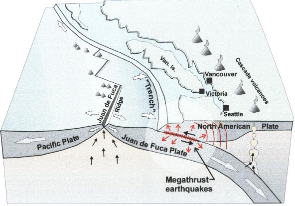
The Natural
Resources Canada website states that in an earthquake “The plates can either slide past one another,
or they can collide, or they can diverge...The west coast of Canada is one of the
few areas in the world where all three of these types of plate movements take
place, resulting in significant earthquake activity.”
I
hope you verify this additional hazard.
I’d
like to remind you of the Enbridge track record for spill clean-up.
Remember
the Kalamazoo River spill of July 2010?
I
have a quote from a news release of October 6th 2011.
“The U.S. Environmental Protection Agency
issued a directive today requiring Enbridge to take additional steps to clean
up the July 2010 oil spill that damaged over 36 miles of the Kalamazoo River
system. The directive requires Enbridge to submit plans by Oct. 20, 2011 for
cleanup and monitoring work expected to last through 2012. Failure to comply
could result in civil penalties. The EPA directive lays out a performance-based
framework for assessing and recovering submerged oil in the river and cleaning
up oil-contaminated river banks.”
The
Kalamazoo river spill happened in July 2010. The US Environmental Protection
Agency found it necessary to give Enbridge a clean-up directive over a year
later and they expect the clean up to carry on throughout 2012 – 2 ½ years from the time of the rupture.
Imagine
how much irreparable damage has been done by this spill. Despite their
up-to-date monitoring technology and clean-up strategies, 36 miles of the
Kalamazoo River is damaged, eco-systems destroyed.
I
hope you have data about the damage, costs, and clean-up efforts for the
Kalamazoo, the Peace River and the Norman Wells spills.
I
feel sickened that the Enbridge pipeline proposal is even being considered
seriously and that it is being pushed by the Harper Government.
The
risks to the B.C. Fisheries; the First Nations territories and culture; the
tourist industry; the pristine wilderness; and the ecosystems all along the proposed
pipeline route, the Douglas Channel, and the Pacific coastline, are not worth any
amount of financial gain.
The
risks are clear. The benefits are not.
Thank
you for listening to the local people all along the line who are speaking out
against this project. This is our home.
Sources:
Letter from John Carruthers in Houston
Today (online) June 2011
Norman Wells spill: http://www.cbc.ca/news/canada/north/story/2011/06/07/nwt-enbridge-pipeline-spill.html
Montana oil spill fouls
Yellowstone River The
Associated Press (online)
Peace Spill: cbc.ca/news
(online)
Saved Letter about Kalamazoo and online
EPA press release
Houston Today newspaper article November
2002 (Houston Public Library)
Natural Resources Canada website (online)
(earthquakes data)
Photo of Equity Tailings Pond Taken by
Mike Aziz Nov. 4/2002 (included & saved)
No comments:
Post a Comment